
“Drone mapping” can mean several different outputs. A site overview for a presentation is not the same deliverable as a georeferenced image for GIS, a surface model for technical review or a 3D model for visual documentation. Start by deciding how you will use the result and who will review it.
Orthomosaic: one connected overhead view
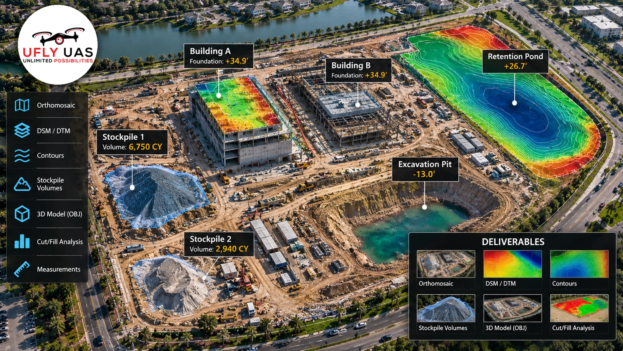
An orthomosaic combines overlapping aerial photographs into an overhead image with geometric corrections. It can help teams view the site as a whole and provide context for visible features. Ask whether you need a simple image for a report or a georeferenced file compatible with your software. Resolution, coordinate information and validation requirements should be agreed rather than inferred from appearance.
Surface models and terrain models
A digital surface model represents the visible surface, which can include buildings and vegetation. A terrain model aims to represent the ground surface. Those are different products. Dense vegetation, hidden ground and incomplete coverage can limit what image-based processing can recover. A colorful height map is useful for visualization but does not, by itself, prove ground elevations or accuracy.
Contours and elevation views
Contours connect locations of equal modeled elevation. They can make changes in a surface easier to understand, but their usefulness depends on the source model, reference system and processing. Confirm the interval, units and intended use with the professional who will interpret the result. Design, permitting and certified survey requirements need the appropriate qualified professional.
3D site documentation
Photogrammetry can create a textured model from overlapping photographs. A 3D view can help someone explore visible site conditions or understand spatial context. Shadows, reflective surfaces and areas not seen by the camera can produce gaps or artifacts. Confirm the viewer, file format and intended audience; a model should be checked for its intended use rather than assumed to be measurement-ready.
Stockpile estimates: agree on the method first
A volume estimate depends on the pile boundary, modeled surface and chosen base. A hidden or uneven base can materially affect the result. Before requesting estimates, discuss units, reference surface, repeatability and validation. If quantities will be used for payment or another consequential decision, agree on professional review and acceptance requirements. Do not treat illustrative stockpile numbers as a measured project result.
Match the output to the task
| Your task | Output to discuss |
|---|---|
| Stakeholder presentation | Overhead overview, labeled photographs and a short video |
| GIS context | Georeferenced orthomosaic with agreed coordinate information |
| Visual site exploration | Textured 3D model or supported interactive viewer |
| Earthwork review | Surface data and estimates with a defined method and validation |
A practical mapping request checklist
- Site address, approximate coverage area and access arrangements.
- Purpose of the data and the person or team reviewing it.
- Required file formats and software compatibility.
- Units, coordinate system and any required accuracy specification.
- Ground control or independent checks where appropriate.
- Deadline, repeat-visit needs and limitations to document.
Flight planning also depends on weather, airspace, people and safe operating conditions. See FAA commercial drone guidance. The capture plan and processing scope should be agreed before collection.
Aerial mapping in New York, New Jersey and Delaware
Explore UFLYUAS aerial mapping services and construction monitoring, including projects in Middletown and Townsend, Delaware. Our aerial data collection does not replace licensed land surveying, certified boundaries or a qualified professional’s interpretation.
Frequently asked questions
Is a drone map automatically survey-grade?
No. A visually detailed result is not proof of positional accuracy. Survey use requires an appropriate workflow, validation and qualified professional involvement.
Which deliverable should I request?
Describe the task and software you need to use. The right output follows from that requirement; ordering every file type can add complexity without helping your project.
Planning a mapping project? Request a mapping quote or email [email protected] with your site location and intended use.
